
See the site constraints and services a property listing won’t show.
Enter an Auckland address. Our own land-check tool brings together Auckland Council, LINZ, Watercare and Vector information, maps planning, flood, ground and servicing findings on and around the property, and emails you a clear report.
Free. About a minute. No obligation.
 Flood and overland flow mapped against the parcel
 Water, wastewater and stormwater mains on or near the title
 Nearby Vector transformer and feeder readings
- 1Address
- 2Site snapshot
- 3Full report
Which property are you looking at?
We’ll confirm the address, then run the check.
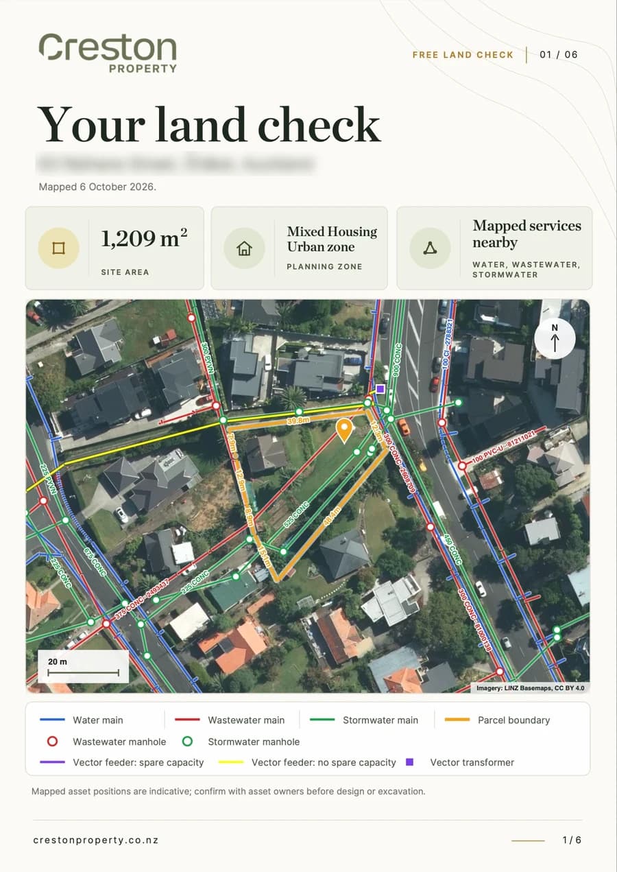
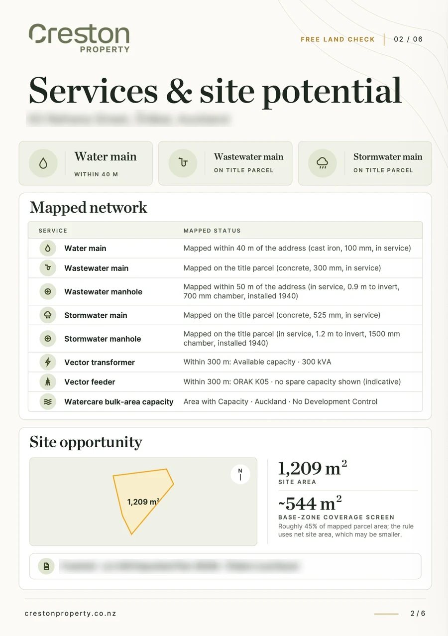
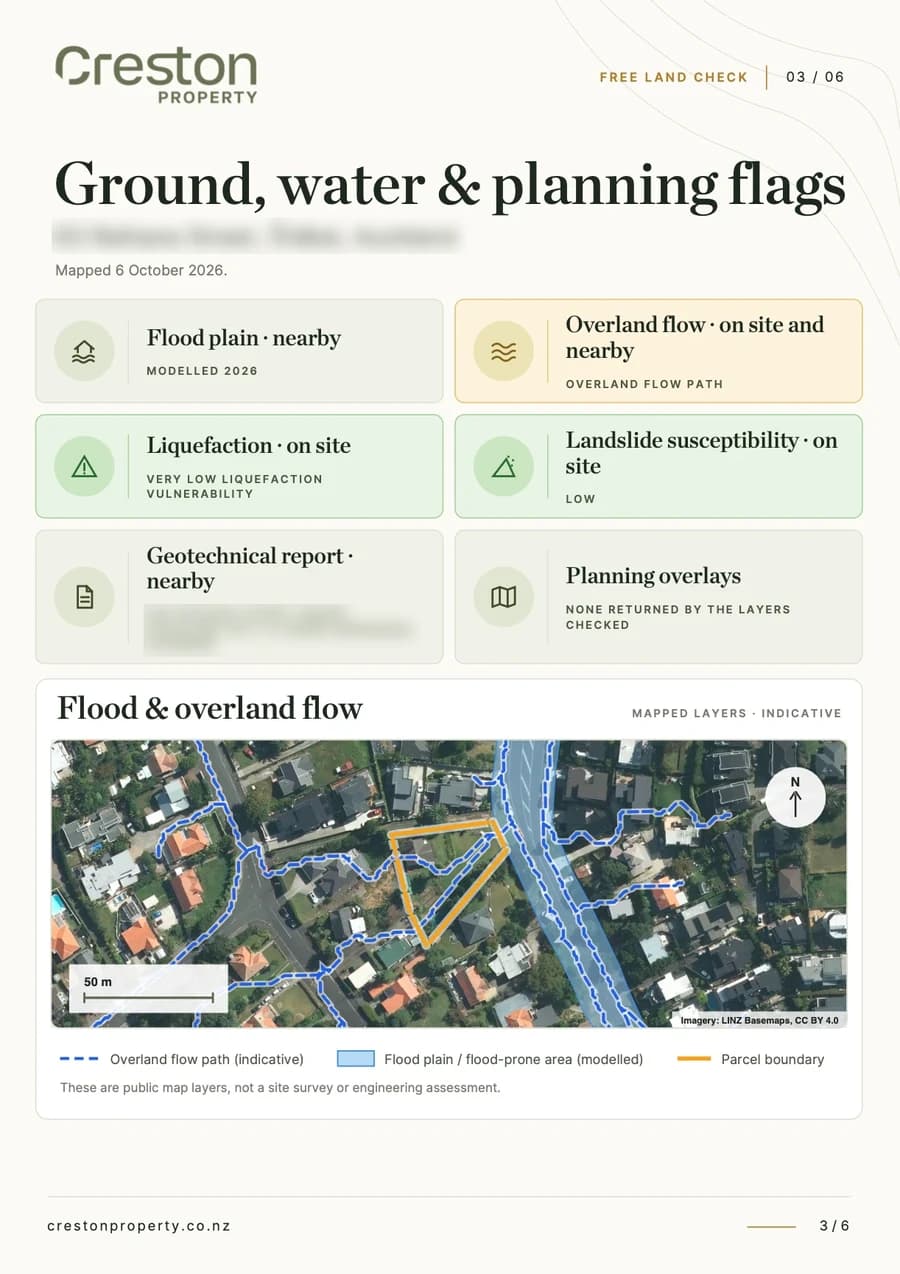
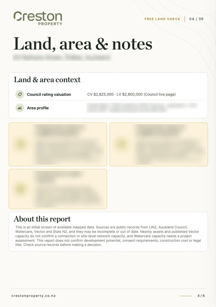
Real report
A fuller picture, in your inbox.
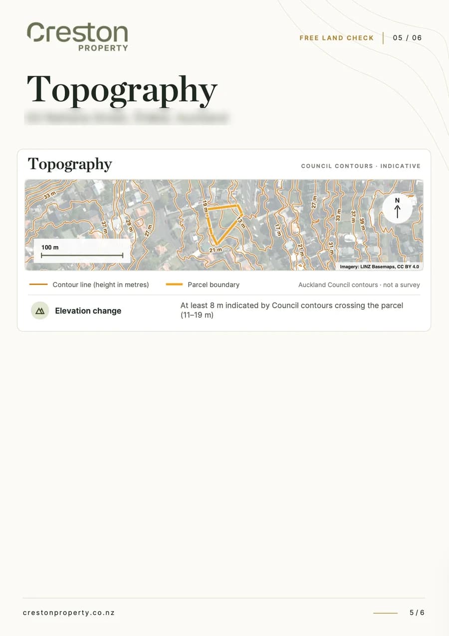
Six pages built around your address: an aerial map with the water, wastewater, stormwater and Vector lines drawn over your boundary, pipe sizes and materials, flood and overland flow layers, ground and planning flags, and local census figures.
You’ll see a quick snapshot straight away, and the PDF follows by email.
Common questions about the land check.
About the land check
Our own land-check tool brings these findings together for your address. Planning: the Auckland Unitary Plan zone, planning overlays and controls, and the site area, boundary and title details. Flooding and ground: flood plains and flood-prone areas, overland flow paths, landslide susceptibility and liquefaction, and how much the site level changes. Services: water, wastewater and stormwater mains on or near the title with pipe sizes and materials, Watercare bulk-area capacity, and the nearest Vector transformer and feeder. Local area: census figures for the surrounding neighbourhood.
The underlying information comes from LINZ for property boundaries and titles, Auckland Council for planning and hazard maps, Watercare for water and wastewater, Vector for electricity, and Stats NZ for local figures. Our own tool brings those sources together, maps relevant layers on and around your property, and presents the findings in one clear report.
It's free, with no obligation, for any address in the Auckland region. You see a quick snapshot of the site on screen, and the full mapped report is emailed to you as a PDF.
No. A LIM is the council's official report on a property and is worth getting before you buy. Our land check is an early site check produced by our own mapping tool. It brings available site information together to guide further due diligence, but does not replace a LIM.
Planning and buying
Your Unitary Plan zone sets what can be built on the site: roughly how many homes, how tall, and how much of the site they can cover. In the residential zones, Single House is the most restrictive, Mixed Housing Suburban and Mixed Housing Urban allow more homes, and Terrace Housing and Apartment Buildings allows the most. Overlays and controls add rules on top of the zone for a particular reason, such as heritage, notable trees, significant ecological areas, protected views or stormwater management. Auckland's planning rules change through plan changes, so treat the zone as a starting point.
It depends on the zone, the size and shape of the site, any overlays, and constraints like flooding, slope and where the pipes run. Two sites in the same zone can end up with very different answers. The land check shows all of these for your address, which is usually enough to tell whether a site is worth looking at further. To work out how many homes it could realistically take and whether the numbers stack up, our feasibility review is $2,700 + GST, fixed price.
See our feasibility reviewIt shows the things that decide it first: the zone, the site area, planning overlays, flood and ground risks, and whether water, wastewater and stormwater mains are close by. It doesn't confirm what can be built. For that, our fixed-price feasibility review works through the planning rules, the layout and the numbers.
See our feasibility reviewThe zone and any overlays, flood plains and overland flow paths, slope and ground conditions, whether water, wastewater, stormwater and power are close by and have capacity, the title type and any easements, and the LIM. Our own land-check tool brings much of the available mapped information together in one report. For a site you're serious about, a feasibility review tells you what you could build and whether the numbers work before you commit.
See our feasibility reviewFlooding and ground
Enter the address above. The land check maps Auckland Council's flood plains, flood-prone areas and overland flow paths against the property boundary, so you can see whether they sit on the site or nearby.
Both come from Auckland Council's flood modelling. A flood plain is land expected to be covered by water in a large storm, the kind with a 1% chance of happening in any year. A flood-prone area is a low spot where water can pond if the drains or outlets block. Either one can limit where homes go and how high their floors need to be, so it's worth knowing early.
It's the route water takes across the ground in heavy rain, once the pipes are full. Water still needs a way through, so you can't simply block it. Building on or near one usually means designing around it, keeping a clear path or managing the flow with an engineer's design, and that affects the layout and the cost. The land check shows whether any cross the site or run nearby.
Liquefaction is when loose, wet ground loses strength and behaves like liquid during an earthquake. Landslide susceptibility is how likely a slope is to move. Auckland Council maps both. A higher rating doesn't rule a site out, but it usually means a geotechnical engineer's report and possibly deeper foundations or retaining, which adds cost.
A sloping site usually means more earthworks, retaining walls and steeper driveways, all of which add cost and can reduce how many homes fit. It also decides whether wastewater can drain to the public main by gravity or needs a pump. The land check shows how much the ground level changes across the site.
Services
Start with where the public wastewater mains run. If one runs along the street or through the site, connecting is usually straightforward. If the nearest one is on a neighbour's land, you'll need their written approval to work there, and that can cost time and money. On one project we worked on, the connection meant a day or two of work at a manhole on the neighbour's property. The neighbour asked for $100,000. The alternative, a new line along the berm to a sewer across the road, was estimated at $30,000 to $40,000 + GST. It settled at $11,000. The land check maps the mains on and around the title, with their pipe sizes and materials, so you can see this coming.
Read the full storyIt has to be managed on the site, usually with soakage into the ground where the soil allows, or tanks that hold the water and release it slowly. Both take up space and add cost, and in some parts of Auckland the rules require them anyway. The land check shows whether a public stormwater main is on or near the title.
It's whether the wider water and wastewater network in your area can take more homes, not just the pipe outside your property. In some parts of Auckland, Watercare limits new connections until upgrades are done. Watercare confirms capacity for each project during consenting, but the land check shows what's known for your area so it doesn't come as a surprise.
Each new home needs a power connection, and the local transformer and the feeder supplying it can only carry so much. If they're close to their limit, Vector may need to upgrade them before new homes can connect, and the developer usually pays for that. The land check shows the nearest Vector transformer and feeder, so you can see early whether power could become an issue.